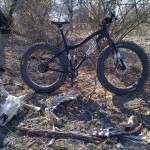
Cracking winter morning ride today, started off at 7°C but was up to the low 20s by the end.
It was my first proper fat ride in the Toteng area, and first time to get my 9:Zero:7 Tusken into proper sand.
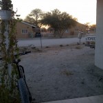
I left Toteng around 7.30am with the sun technically risen but still hiding behind the houses and trees, fingers were a bit chilly and happy to have put a vest under my t-shirt.
On my back I had 1.5l of water and a couple of Special K Red Berry Cereal Bars (all I could find: 90kcal each, not exactly rocket fuel). Night-before fueling comprised a large steak and half a plate of my homemade coleslaw.
Pre-ride planning had amounted to feeding a dozen waypoints into Garmin Basecamp and creating a route to load into my Edge 705. Seemed to work well, although it is irritating that the default flags and pins of Garmin and Google Earth still use the centre of the icon for the coordinate rather than the point of the flagstaff/pin.
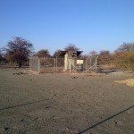
I rolled through the mostly-sleeping village of Toteng and swung onto the Old Ghanzi Road to cross the Nhabe River – slowly filling from the downstream end as the Kunyere River backs up. Old Ghanzi Road leads to the Boseto Copper Project, so quite a bit of traffic and best to turn off as soon as possible.
An interesting feature of this part of the country is the Thamalakane Fault (and parallel Kunyere Fault), the features responsible for the Okavango Delta and associated features. In the bush to the south of Toteng there is a seismic monitoring station operated by the Botswana Geological Survey. It would be interesting to see what they see when the mine blasts in the pit: we can certainly hear it in Toteng village.
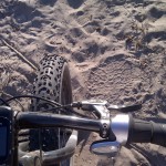
Pressing on, I wend my way past cattle-posts and empty fields and soon find the first signs of non-human/cattle activity. I’m riding parallel to the river and mostly they are crossing my path, obviously moving between the feeding grounds and waterholes – as evidenced by the amount of poop down in the river earlier this week.
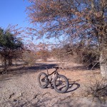
About a third of the way in, so take a break and have a cereal bar. Nice, not to cloying, rinsed down with a few sucks of water from the Camelbak. And some gratuitous bike pictures: lovely light at this time of day.
The sand around here is aeolian: blown by the wind. Typical of the Kalahari desert. In a few places there are calcrete outcrops, but few and far between.
From the dizzy heights of Google Earth I had identified a track running more or less east-west parallel to the river, it turned out not to be much of a track: in a few places there are vehicle tracks leading to cattle-posts but mostly single-track cattle trail on soft, dry sand: perfect fatbike territory it turns out. Slow going, but with the NuVinci indicator showing a midrange ratio it just keeps going.
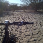
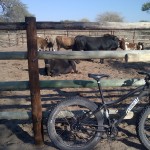
Cracking on, some meandering as the trail comes and goes until I get to a kraal where cattle are gathered before being transported to pastures new or the abattoir.
Near here I meet a jolly farmer who asks where I am going:
Me: “Toteng”
Him: “Toteng, qua!” <pointing back the way I just came>
Me: “Ee, rra, but I am going round!” <large circular sweeping motion of arm>
Him: “Careful, the tsotse are many!”
Me: [thought] “Tsotse? You’re the first person I’ve seen for an hour. I’m more worried about the elephant!”
Me: “Ke itumetse, rra, sala sentle.”
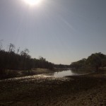
The kraal is associated with a small settlement and I pass a two-room occasional-clinic before dropping down the escarpment (all 20m of it) into the bed of the Nhabe River. There is pool of standing water and the ground is well-trodden by cattle (and a few elephant).
A short stretch along the river bed and it’s time to climb out the other side to get back to the old Maun-Toteng road for the final leg. You will see from the satellite view that there is some well developed riverine forest and here the elephant prints were many, but, being elephant, they are most elusive and manage to keep themselves hidden.
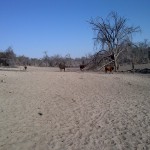
The climb was interesting: some heavy vehicle tracks in the sand – maybe 10cm deep and still loose in the bottom. The sand varies in grain size and the finest, loosest places were interesting to ride through. You feel the fat tyres settle into the sand and the friction increase: not unlike riding or driving into a deep puddle, then they float, grip and you carry on (albeit a little more slowly). Fantastic.

At the top of the climb I swing west onto the old road: quite overgrown with sections of the original gravel covered by that soft aeolian sand.
It is now winter, and very dry. The standing water in the river is all well and good but the surrounding land is terribly overgrazed. The lack of feed, exacerbated by lack of opportunity to sell stock and so buy supplements, means that a large number of cattle in Ngamiland starve. In fact, this year has already been declared a drought.
The last 7km were unremarkable and I rolled home with 32km under the wheels in an overall time of 3hrs. Not exactly Tour de France pace, but I’d like to see those guys get through the sand on 23mm wide tyres!