May 2015
Winter afternoon journey from Francistown to Gaborone along the A1.
News and stuff from Botswana
Postings about Botswana related items.
May 2015
Winter afternoon journey from Francistown to Gaborone along the A1.
My Facebook and Twitter feeds have been buzzing with confusion for the last couple of weeks since Botswana Power Corporation announced a new scheme to reduce power usage.
Load-shedding has been a fact of life in Botswana for years now, and recent announcements about a new scheme known as Demand Side Management have led to lots of noise across social media, mainly from people enquiring how to calculate their power consumption so they don’t get cut off.
With this post I hope to clarify some of the confusion and help people be better informed, you might even save money when you review what is using power in your house. Continue reading “Botswana Electricity – Load Shedding and Demand Side Management”
I’ve been aware of the Degree Confluence Project for a while now, and despite there being some unvisited confluences not too far from home I never got round to visiting them.
A few days ago a friend and I were putting the world to rights under the influence of anti-malarial medication, we got to the pleasures of following trails to see where they go, and my memory was refreshed. A visit to the DCP website for Botswana revealed an unvisited confluence not far from where we work, and having passed within a few kilometres earlier in the year I knew it would be possible to get with about 15km.
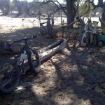
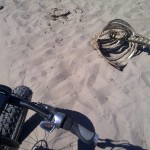
Another Saturday Session on the 9:Zero:7, crossed the Nhabe early (in the route, left home a bit late) with the aim of a longer loop out to Makkhalo and back along the Old Maun Road.
The elephant had been down in the river drinking from the pools, and their tracks led up the south bank right where I was going. This trend continued pretty much all morning. Mostly crossing my track at right angles as they move from water to their feeding grounds, but at times tracing my route.
More evidence of lack of grazing for cattle, in fact most of the animals I saw were goats. Near Makkhalo I met a pleasant madala, a Water Utilities employee from the area, posted back here since WUC took over water supply in Ngamiland. He was busy stocking his masimo with goats: “We’re preparing for vaccinations, come back in 6 months, this place will be full,” he told me proudly. He was very interested in the how well the bike moved on sand, and asked whether I’d seen any elephant.
None seen, but at one of my food stops I’m sure I heard one on the other side of the river, that or a cow with a sub-woofer.
All along the Nhabe there are kraals for cattle and goats, suggesting that even though the river hadn’t flowed for many years there was water stored below the bed of the river, thankfully it has flowed seasonally every year for the last 3-4 years and the water table has been replenished, and now lies just below the riverbed. I found several spots with water-troughs carved out of tree trunks, and still in daily use judging by the moisture and tracks.
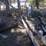
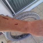
Today’s route was slightly north of last week’s session, using cattle trails rather than vehicle tracks. Lots of meandering as the main trail disappeared in a mass of converging and diverging tracks, and not a few encounters with thorn bushes.
After some midweek dramas with by ghetto tubeless fat tyre rig (a leak that Slime wouldn’t seal, had to resort to a tubeless plug) I’m please to report there was only one stop for pumping in the whole ride. The front wheel is charged with Stan’s Sealant and does a good impression of a bad German movie after a vigorous penetration – anything up to a minute! Also seems to be taking longer to seal, so maybe time to recharge the tyre-jism.
Turning north at Makkhalo put me on to a trail that was… testing. Soft, draggy sand for >5km, some places was I was reduced to pushing, and swearing. Might explain why, despite all the poop and footprints, I didn’t see a single pachyderm.
It was relief to get on to the old Maun road (disused track running more or less parallel to the new tar road) – although some of the sand-dunes blown across the track made it tough going, and it almost killed me when I set the GPS to give me distance to Toteng, rather than the end of the route: “distance to go” went from 5km to 10km… had put the last route point at a junction where I was considering taking a detour. With food and water finished I wasn;t keen on that, so straight home. Wonderful to get some hardpack gravel where I could situp and ride no handed – been a while since I did that!
Final result: a Strava Suffer Score of 148 and wildly differing calorie consumptions between Garmin and the various cloud-based trackers (1,066kcal from Garmin, 1688kcal on SportTracks, 4557kcal on Endomondo and 988kcal from Strava). No idea which one reflects the reality of grinding through sand for five hours, though. It did put me into the Top 1000 (12%) on the Fitocracy 30 day leaderboard, which is nice.
