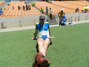
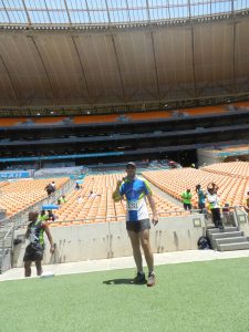
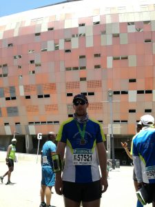
Soweto Marathon 2017

It’s 10 months since my last post (so much for the “I will write more” resolution), and the theme is the same: I ran another marathon (with another one coming up in just over a month).  Yes, I’m the subject of the joke that goes “How do you know whether somebody has run a marathon?” answered by “They’ll tell you about it.”  However, if one person reads the post and thinks “I’ll try that” then it’s worth it.
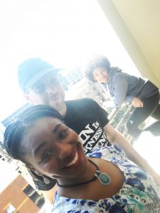
60% of Knott In Botswana on a balcony.

Thanks to convenient school mid-term holiday Gwyneth was able to join us this time.

The Preparation

Fresh from my relative success at the Diacore Gaborone Marathon I decided to follow a similar training plan mixing up rowing, running, and cycle commuting.
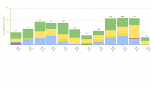
Training record for the months leading up Soweto Marathon 2017.

Both events happened early in the month (May and November, respectively), so the main training load can be seen in the preceding three months.

Diacore        all in km
  Run Ride Row  
Feb-17 160 113 108  
Mar-17 102 110 149  
Apr-17 187 118 54  
 Total 449 341 311 1101
Soweto        
  Run Ride Row  
Aug-17 199 117 119  
Sep-17 145 153 141  
Oct-17 115 217 94  
 Total 459 487 354 1300

I managed to put in an extra 200km of effort: only 10km running, but 140km cycling and 40km rowing.  The difference in rowing is just because of when I completed the rowing plan: for Diacore I started about one week earlier.  Cycling I just managed to put in more commuting distance.  Due to a change in work I missed out most evening bus runs in October, and also got hammered two weeks before the event with an attack of shingles.

The Event
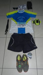
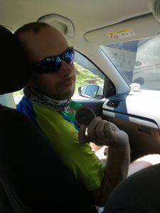
Race gear for Soweto Marathon 2017.

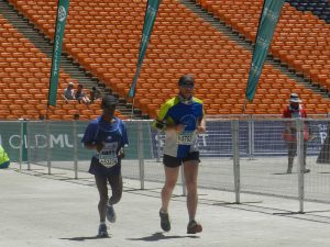
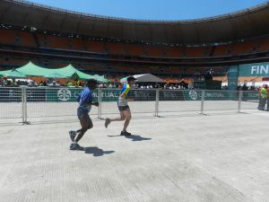
The run itself was good. Lots of hills, which I like, and lots of people to chase down when churning a steady pace up and down hill.  Provision of refreshments was a significant step up from Diacore with well stocked refreshment tables.

My refreshment strategy was a cup of coke and water sachet at pretty much every table: coke for the sugar rush, and water to alternately wash it down or spray over myself for cooling.

It was a pretty good effort overall: I felt comfortable throughout and in hindsight could maybe have pushed harder. I had decided to start gently, not knowing how bad the hills would be.  Certainly the last half was mainly uphill but I felt like I had plenty in reserve: even passing some Gaborone Striders‘ veterans.

Running through the historic parts of Soweto was great, and the crowds supportive throughout.  Definitely one to repeat.

Supporting Acts

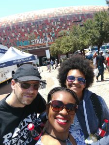
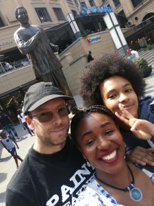
We decided to make a long weekend of it, I was on an induction with my new employer during Thursday and Friday, so Prisca and Gwyneth joined me on Friday.

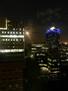
We rented an apartment high up in a Sandton apartment block, with its own private elevator (shame we didn’t have a private car…), and spent the non-running time shopping.
Metsimotlhaba – River Things

Went out on a little bicycle ride this morning that took me past Mmopane down to the Metsimotlhaba River, through Metsimotlhaba village and almost (but not quite) to Gabane before heading back past Mogoditshane.

For me cycling gives me time to reflect on life, the universe and everything. Once I got down to the river my mind was turned from personal reflection to consideration of the universe, or a tiny part of it: the Metsimotlhaba River.

I actually remember watching a news story on Btv maybe 10 years ago in which the residents of Metsimotlhaba and Mmopane were complaining to their councillors about the heavy trucks driving through their villages at speed carrying sand from the river to construction projects in Gaborone. A quick internet search gives a host of media reports on the subject.

It actually started as I crossed the river near Letlhajweng: a large yellow 4-axle tipper truck was stuck in the riverbed with a bunch of guys trying to dig it out – no pictures as they were quite likely operating illegally.  A flash-flood would have been nice…

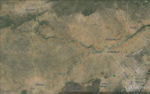
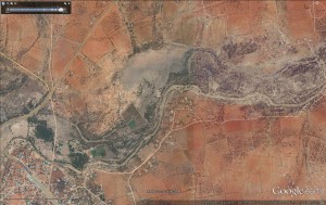
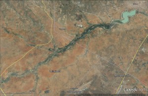
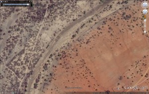
From Google Earth satellite imagery it can be seen that the watercourse from Metsimotlhabe village to Bokaa Dam is quite flat, with typical floodplain geography: silt and clay, good vegetation, signs of changing river course, etc..

Interestingly the river channel becomes less pronounced as you get closer to Bokaa Dam, and I’m guessing that this is because when full the dammed water reaches back as far as Kopong, so there has been deposition across the whole floodplain.

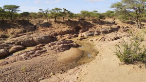
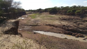
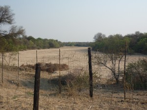
As you move upstream from Kopong towards Letlhajweng the river channel starts to become more developed, until near Metsimotlhaba village the channel must be in excess of 4m deep and 50m wide – if not more.  And completely lacking in sand.  This is in stark contrast to many rivers elsewhere in Botswana that have thick sand beds, like the Ramokgwebana in the north-east.

I’ve tried to establish whether the state of the river bed at Metsimotlhaba village is due to sand mining or if there is some other reason, possibly geological, why there is no sand in the channel.

It is possible that there were historical restrictions to the flow that caused a build up of fine sediment (silts and clays, as visible in the banks) in the riverbed, and now these have either eroded or the land has tilted slightly, with the result that the sediments are now eroding to form the visible channels.

The alternative is that there was a shallow channel with sands, as would be typical elsewhere, and now that the sand has been extracted the increased flow rates are scouring the bed and banks

Further upstream there are signs that the thick sand bed does exist, traditional thorn enclosures round hand-dug well points are in evidence, and also more sand mining.  Next ride out there I will have to go down to the river and see what kind of sand it is, and maybe see if I can find an old person who might remember back to before Gaborone’s construction boom.

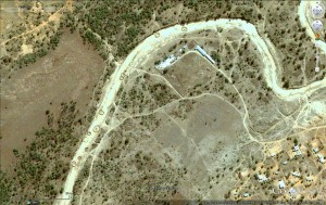
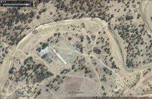
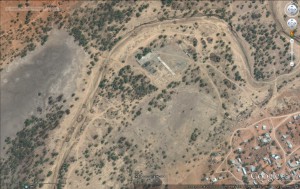
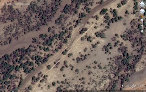
The pictures below show a meander just west of Metsimotlhabe village, between 2002 and 2015 the number of well points has reduced.  Different colour spectra makes it difficult to gauge sand content, but considering the generally light nature of 2002 and the reduced number of light patches in 2014 there is a suggestion that the amount of light sand has reduced significantly.  The layout of the large compound in the meander is also reminiscent of a brick making yard – the long concrete slab is where fresh bricks are set while the cement cures.

Other developments in the floodplain are more clearing for agricultural use, which is strange when so many fields lie fallow, obviously not having been ploughed for several years.  I understand that people may not have capacity to plough and that we experience unreliable rainfall (heavy drought expected this year), but why can’t agricultural and environmental departments work on getting the already cleared land put to productive use instead of more bush clearing and associated negative impacts?

Despite the various comments from officials about the negative impacts of sand mining in the search results linked above it is clear that the activity is still rife: the truck I found stuck in the river and also in satellite images.

Makkhalo Loop

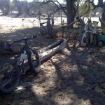
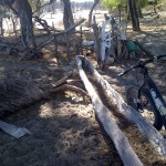
Hand-dug well and cattle-trough carved from a tree.
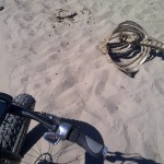
Random rib cage somewhere near Makkhalo, and sand.

Another Saturday Session on the 9:Zero:7, crossed the Nhabe early (in the route, left home a bit late) with the aim of a longer loop out to Makkhalo and back along the Old Maun Road.

The elephant had been down in the river drinking from the pools, and their tracks led up the south bank right where I was going. This trend continued pretty much all morning. Mostly crossing my track at right angles as they move from water to their feeding grounds, but at times tracing my route.

More evidence of lack of grazing for cattle, in fact most of the animals I saw were goats. Near Makkhalo I met a pleasant madala, a Water Utilities employee from the area, posted back here since WUC took over water supply in Ngamiland. He was busy stocking his masimo with goats: “We’re preparing for vaccinations, come back in 6 months, this place will be full,” he told me proudly. He was very interested in the how well the bike moved on sand, and asked whether I’d seen any elephant.

None seen, but at one of my food stops I’m sure I heard one on the other side of the river, that or a cow with a sub-woofer.

All along the Nhabe there are kraals for cattle and goats, suggesting that even though the river hadn’t flowed for many years there was water stored below the bed of the river, thankfully it has flowed seasonally every year for the last 3-4 years and the water table has been replenished, and now lies just below the riverbed. I found several spots with water-troughs carved out of tree trunks, and still in daily use judging by the moisture and tracks.

Hand-dug well and cattle-trough carved from a tree.
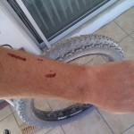
Arm-thorn bush interface.
Encounter with a thorn bush.

Today’s route was slightly north of last week’s session, using cattle trails rather than vehicle tracks. Lots of meandering as the main trail disappeared in a mass of converging and diverging tracks, and not a few encounters with thorn bushes.

After some midweek dramas with by ghetto tubeless fat tyre rig (a leak that Slime wouldn’t seal, had to resort to a tubeless plug) I’m please to report there was only one stop for pumping in the whole ride.  The front wheel is charged with Stan’s Sealant and does a good impression of a bad German movie after a vigorous penetration – anything up to a minute! Also seems to be taking longer to seal, so maybe time to recharge the tyre-jism.

Turning north at Makkhalo put me on to a trail that was… testing. Soft, draggy sand for >5km, some places was I was reduced to pushing, and swearing. Might explain why, despite all the poop and footprints, I didn’t see a single pachyderm.

It was relief to get on to the old Maun road (disused track running more or less parallel to the new tar road) – although some of the sand-dunes blown across the track made it tough going, and it almost killed me when I set the GPS to give me distance to Toteng, rather than the end of the route: “distance to go” went from 5km to 10km… had put the last route point at a junction where I was considering taking a detour. With food and water finished I wasn;t keen on that, so straight home. Wonderful to get some hardpack gravel where I could situp and ride no handed – been a while since I did that!

Final result: a Strava Suffer Score of 148 and wildly differing calorie consumptions between Garmin and the various cloud-based trackers (1,066kcal from Garmin, 1688kcal on SportTracks, 4557kcal on Endomondo and 988kcal from Strava). No idea which one reflects the reality of grinding through sand for five hours, though. It did put me into the Top 1000 (12%) on the Fitocracy 30 day leaderboard, which is nice.

Socks and legs covered in Kalahari sand.
Covered in Kalahari sand.